The concept of whether the Middle East was ever part of Africa is profound, stirring curiosity about the connections between the regions.
While the Middle East is generally considered part of the larger region of Africa, it also extends into Western Asia.
Northern African countries such as Morocco, Egypt, Tunisia, and Algeria have unique historical interrelations with the Middle East, highlighted by ethnographic and geographical ties that set them apart from other African nations.
These interrelations paint a vivid picture of how intertwined the histories and cultures of these regions are.
Geographical Definitions
Africa is the world’s second-largest continent, covering approximately 30.3 million square kilometers. It is bounded by the Mediterranean Sea to the north, the Atlantic Ocean to the west, and the Indian Ocean to the east.
The continent’s northern border is typically considered to be the Mediterranean coastline. This includes countries like Egypt, Libya, Tunisia, Algeria, and Morocco.
The Sahara Desert spans much of northern Africa, creating a natural barrier between sub-Saharan Africa and the Mediterranean coast. This vast expanse has historically influenced cultural and economic interactions between these regions.
Defining the Middle East
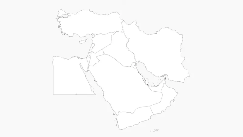
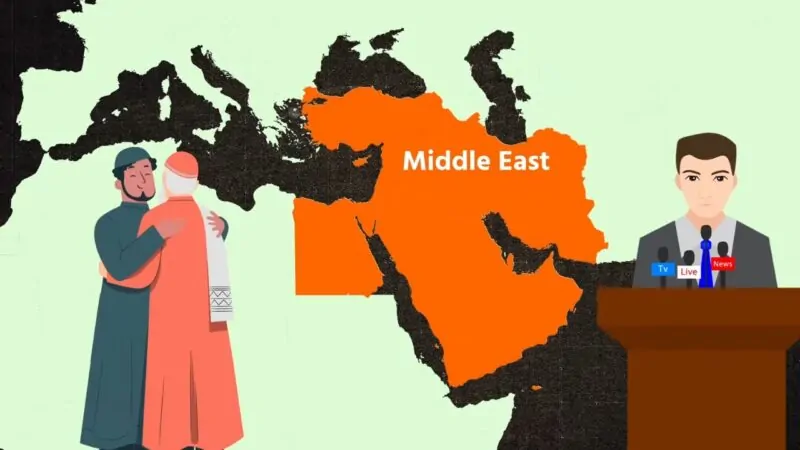
The Middle East is a geopolitical region encompassing the Arabian Peninsula, the Levant, Turkey, Egypt, Iran, and Iraq. Its precise boundaries are subject to debate and can vary depending on political, cultural, or historical contexts.
Generally, the Middle East extends from Egypt in the west to Iran in the east, and from Turkey in the north to Yemen in the south. Some definitions include North African countries west of Egypt.
The region is known for its strategic location at the crossroads of Europe, Asia, and Africa. It includes diverse landscapes, from Mediterranean coasts to arid deserts and mountainous terrain.
Notably, Egypt is often considered part of both Africa and the Middle East, serving as a geographical and cultural bridge between the two regions.
Plate Tectonics and Land Formation
The African continent was formed from ancient Precambrian cratons, including the Kaapvaal, Zimbabwe, Tanzania, Congo, and West African cratons. These stable landmasses emerged between 3.6 and 2 billion years ago. Younger fold belts developed along their boundaries from 2 billion to 300 million years ago.
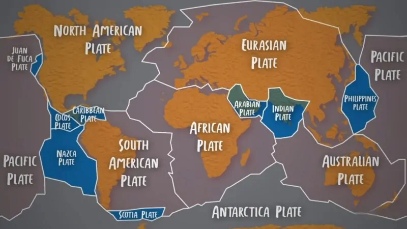
Plate tectonics played a crucial role in shaping the region. The African and Arabian plates were once joined as part of the supercontinent Gondwana. Over millions of years, these plates slowly separated and moved.
The formation of the Red Sea rift began around 25 million years ago, gradually pushing Arabia away from Africa. This process created the distinctive geography of the Middle East and northeastern Africa seen today.
Historical Separation of Landmasses
The separation of the Middle East from Africa occurred gradually over geological time. The Arabian Peninsula began to split from Africa during the Oligocene epoch, about 34 million years ago.
This separation accelerated about 5 million years ago, leading to the formation of the Red Sea and Gulf of Aden. The process continues today, with the Arabian Plate moving northeastward at a rate of about 1-2 centimeters per year.
The Sinai Peninsula acts as a land bridge between Africa and the Middle East. It represents the remnant connection between these once-unified landmasses. The Isthmus of Suez, now cut by the Suez Canal, marks the traditional boundary between Africa and Asia.
Continental Drift Theory
Continental drift theory proposes that Earth’s continents have moved across the planet’s surface over geological time. This groundbreaking idea was introduced by Alfred Wegener in the early 20th century.
Wegener’s theory suggested that all continents were once part of a single landmass called Pangaea. He based this on several observations:
- The shapes of continents seemed to fit together like puzzle pieces
- Similar fossils and rock formations found on different continents
- Evidence of ancient climates inconsistent with current continental positions
Despite these compelling arguments, the scientific community initially rejected Wegener’s theory. Critics argued that there was no known mechanism to move continents across the Earth’s surface.
It wasn’t until the 1960s that plate tectonics theory emerged, providing a mechanism for continental movement. This new understanding incorporated continental drift and explained how tectonic plates carrying continents could move over millions of years.
Today, continental drift is recognized as a crucial component of plate tectonics. It helps explain various geological phenomena, including:
- Mountain formation
- Earthquakes
- Volcanic activity
- Ocean basin creation
Modern technology, such as GPS measurements, has confirmed that continents are indeed moving, typically at rates of a few centimeters per year.
Political and Cultural History
Ancient Civilizations

Ancient civilizations in the Middle East and North Africa were closely connected. Egypt’s pharaonic dynasties exerted influence across both regions. The Phoenicians established trade networks linking the Levant to North Africa.
In Mesopotamia, Sumerian city-states gave rise to powerful empires like Babylon and Assyria. These empires expanded their reach into parts of Northeast Africa.
The Persian Empire united vast territories from Egypt to Central Asia under a single political entity. This facilitated cultural exchange between regions now considered separate.
Colonial and Modern Boundaries
European colonialism in the 19th and 20th centuries reshaped Middle Eastern and African borders. The Ottoman Empire’s decline led to new nation-states emerging across both regions.
The Sykes-Picot Agreement of 1916 divided Ottoman territories between Britain and France. This created artificial boundaries that cut across ethnic and religious lines.
Post-World War II decolonization led to independence for many countries. However, colonial-era borders remained largely intact. This has contributed to ongoing conflicts and disputes.
The Suez Canal’s construction in 1869 strengthened Egypt’s ties to the Middle East. It also increased European interest in controlling the region.
Influence of the Roman Empire

The Roman Empire played a crucial role in shaping the Middle East and North Africa. At its peak, Roman control extended across the Mediterranean coastline, including parts of modern-day Egypt, Libya, and Tunisia.
Roman rule brought urbanization and infrastructure development to many areas. Cities like Alexandria in Egypt became important centers of trade and learning. The empire’s administrative systems and legal codes left lasting impacts.
Roman influence declined in the 7th century CE as Arab Muslim conquests reshaped the region. However, Roman cultural and architectural legacies persisted in many areas long after political control ended.
Islamic and Ottoman Empires’ Impact
The rise of Islam in the 7th century CE profoundly transformed the Middle East and North Africa. Arab Muslim armies rapidly conquered territories from Persia to Spain. This expansion created a vast empire uniting much of the Middle East with North Africa.
The Islamic Golden Age saw advancements in science, mathematics, and philosophy. Cities like Baghdad and Cairo became major intellectual centers. Trade networks intensified connections between Middle Eastern and African regions.
Later, the Ottoman Empire ruled much of the Middle East and North Africa from the 16th to early 20th centuries. Ottoman control further integrated these areas politically and culturally. However, European colonialism in the 19th and 20th centuries redrew borders and reshaped regional identities.
Modern Geopolitical Considerations
Several Middle Eastern countries have pivoted towards Africa, expanding their economic and political influence on the continent. This trend has strengthened ties between the two regions.
Gulf states, in particular, have increased their presence in Africa. They’ve invested in infrastructure projects and formed strategic partnerships with African nations.
The proliferation of regional conflicts has also reshaped the geopolitical landscape. These conflicts often spill across borders, affecting both Middle Eastern and African countries.
Climate change and resource scarcity are emerging as critical factors. They’re driving cooperation between Middle Eastern and African nations on issues like water management and food security.
International powers continue to play a significant role in the region. Their involvement often spans both the Middle East and North Africa, further intertwining the two areas.
So in conclusion, it is considered in the wider African area.